AEC Excellence Awards, winner in the category of large scale infrastructure design projects
Overview
Project Summary
13 km line structure
11 stations
Services
Location
Period
Employer/Client
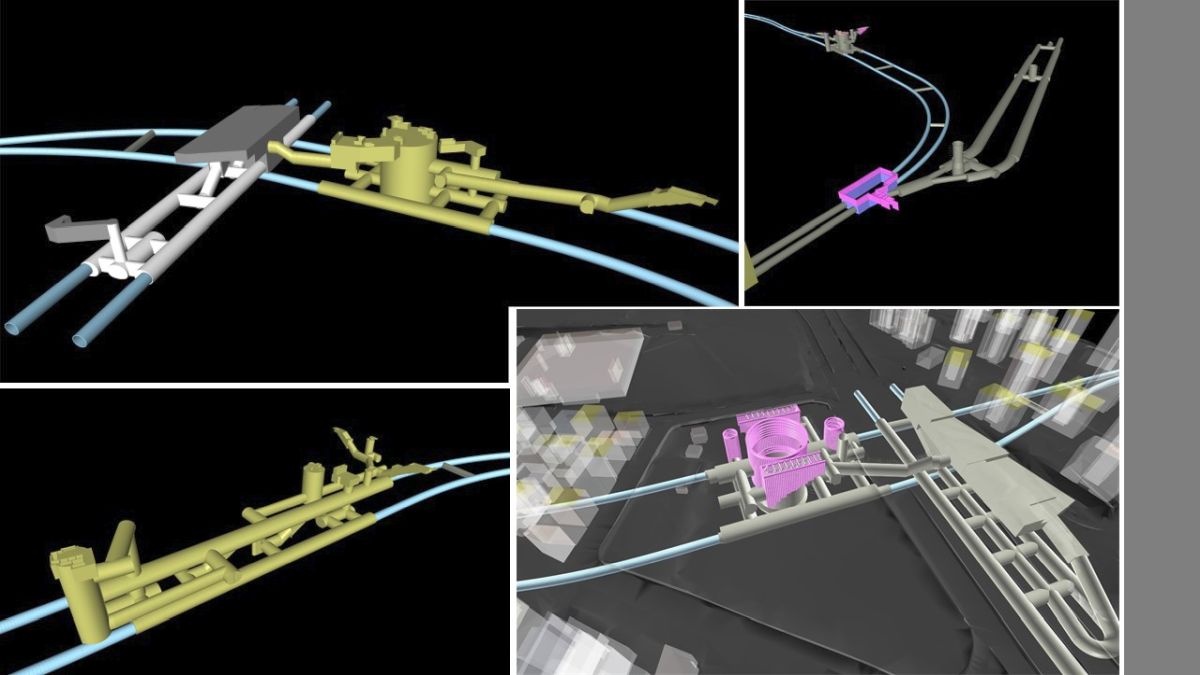

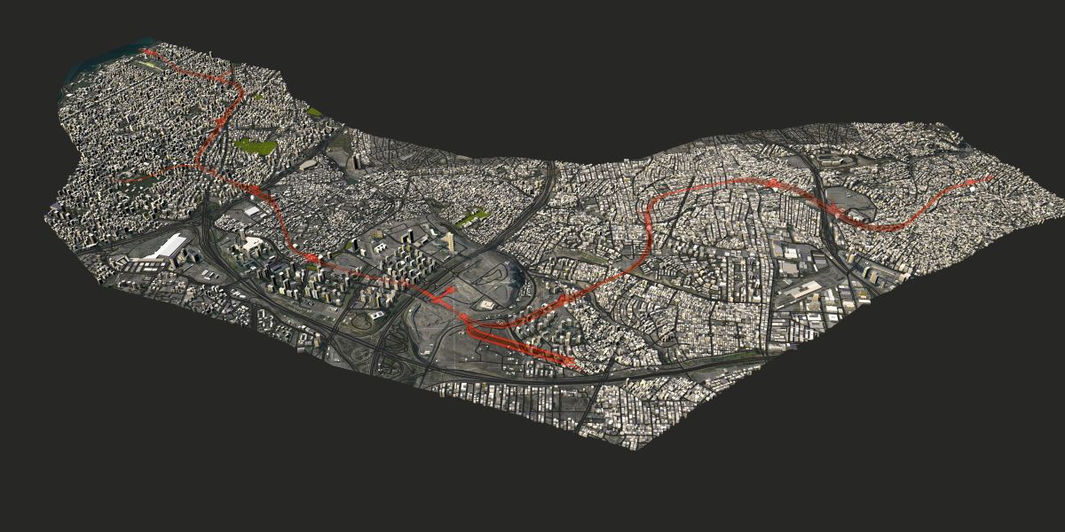


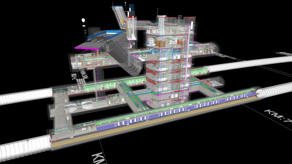

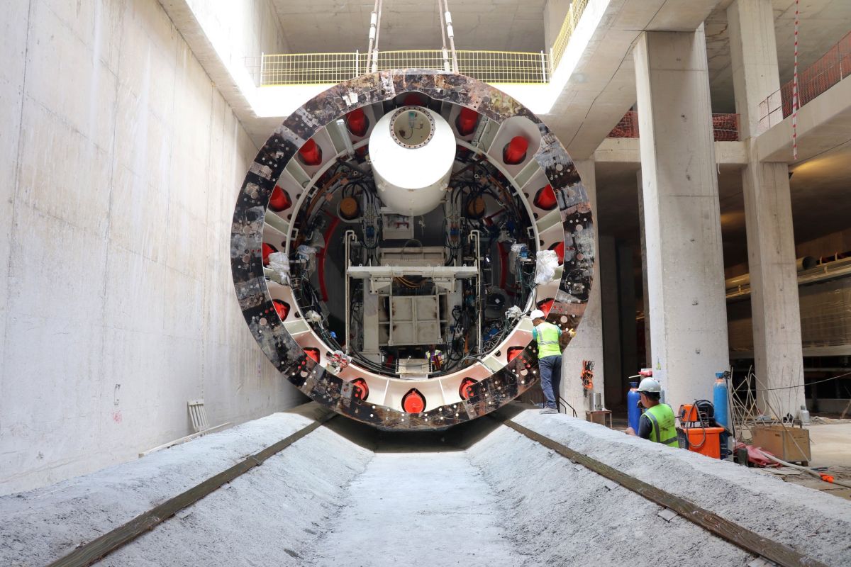

The Umraniye-Atasehir-Goztepe rail system involves a 13 km long rail structure, 11 stations consisting of 7 bored tunnel stations and 4 cut & cover stations, 1 km long stabling line and the connection structure to the Dudullu-Bostancı rail system. The service provided includes the alignment design, design of the TBM and NATM tunnels, architecture of the station entrance and exit structures, excavation support design and structural design, and the design of E&M systems for the whole of the line and the stations.
“The Umraniye-Atasehir-Goztepe Metro Project, with a length of 13 km and 11 stations, is one of the projects in which BIM has been used most extensively in any metro project to date. Studies into the use of both design and construction BIM are carried out through information models created for the stations, temporary storage area and line structures.
Coordination activities are undertaken on the created models and errors are detected before field applications. Structure-environment interaction studies (buildings, infrastructures, roads, etc.) are carried out with models of the current situation created for the whole route. Work program simulations are prepared using information models. In addition, by providing element-based entries of the progress data of the whole process, these simulations and visual reports are used in construction process meetings. Using digital models for construction site mobilization, the mobilization process is managed more effectively in a densely urbanized region like Istanbul. Finally, the virtual project model created for the stretch of 13 km makes it possible for the metro line to be examined as a whole in a digital environment.”
Serhat Kaş
Yüksel Proje BIM Manager